 |
1785.1
CARTE GENERALE DES TREIZE ETATS-UNIS INDEPENDANTS DE L'AMERIQUE
SEPTETRIONALE POUR SERVIR AU SPECTATEUR AMERICAIN 1785.
Only the Pennsylvania region is shown; the complete map
depicts the east coast from Maine to the Carolinas. The
map is from Joseph Mandrillon's Le spectateur
am ricain, published by E. Flon, Amsterdam 1785,
according to the Library of Congress from where this
image comes (Sellers & van Ee #759). Originally by
Rigobert Bonne, it first appeared in 1782 (map 1782.3)
and previously in Le spectateur (McCorkle #784.9).
See McCorkle #785.1, who illustrates several versions.
The map is behind the times as Pittsburgh is called 'Ft.
Duquesne.' Pennsylvania is given a western boundary from
'Sandoske Ft.' to the Ohio River and then following the
Monongahela down to Maryland. An image of this map can be
seen at
MapForum.Com
, Issue 1, where it is dated
1783 and said to come from Alexander Cluny's Le
Voyageur Americain. |
| |
1785.2
CARTE DES ETATS UNIS. A map of the eastern United States
covered with line shading and letters which refer to
accompanying tables. McCorkle #785.2 |
| |
1785.3
CARTE GENERALE DES TREIZE ETATS UNIS, DE L'AMERIQUE
SEPTENTRIONALE KAART VAN DE DERTIEN VERENIGDE STAATEN, IN
NOORD AMERIKA. a Amsterdam chez C. Mortier & J.
Covens et fils. A map with both French and Dutch titles
that covers the familiar territory from Newfoundand to
Florida and west. Pennsylvania extends to 43 degrees with
its western boundary ending at the Forks of the Ohio.
This map can be seen at
MapForum.Com
, Issue 1, dated circa 1783,
and described as a republishing of the Covens &
Mortier copy of John Mitchell's map with "United
States" added to the title. McCorkle #785.3; Sellers
& van Ee #760. |
 |
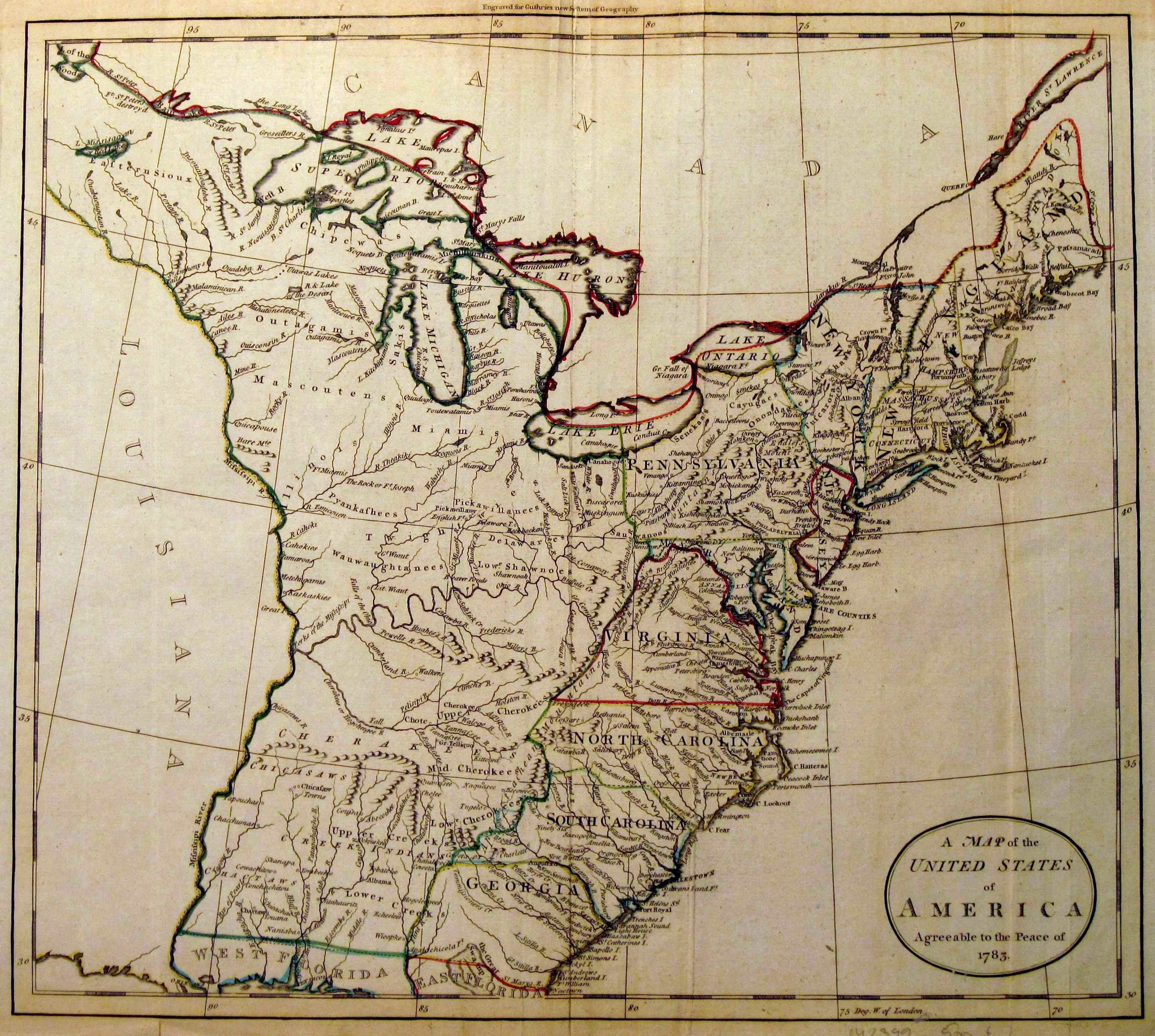
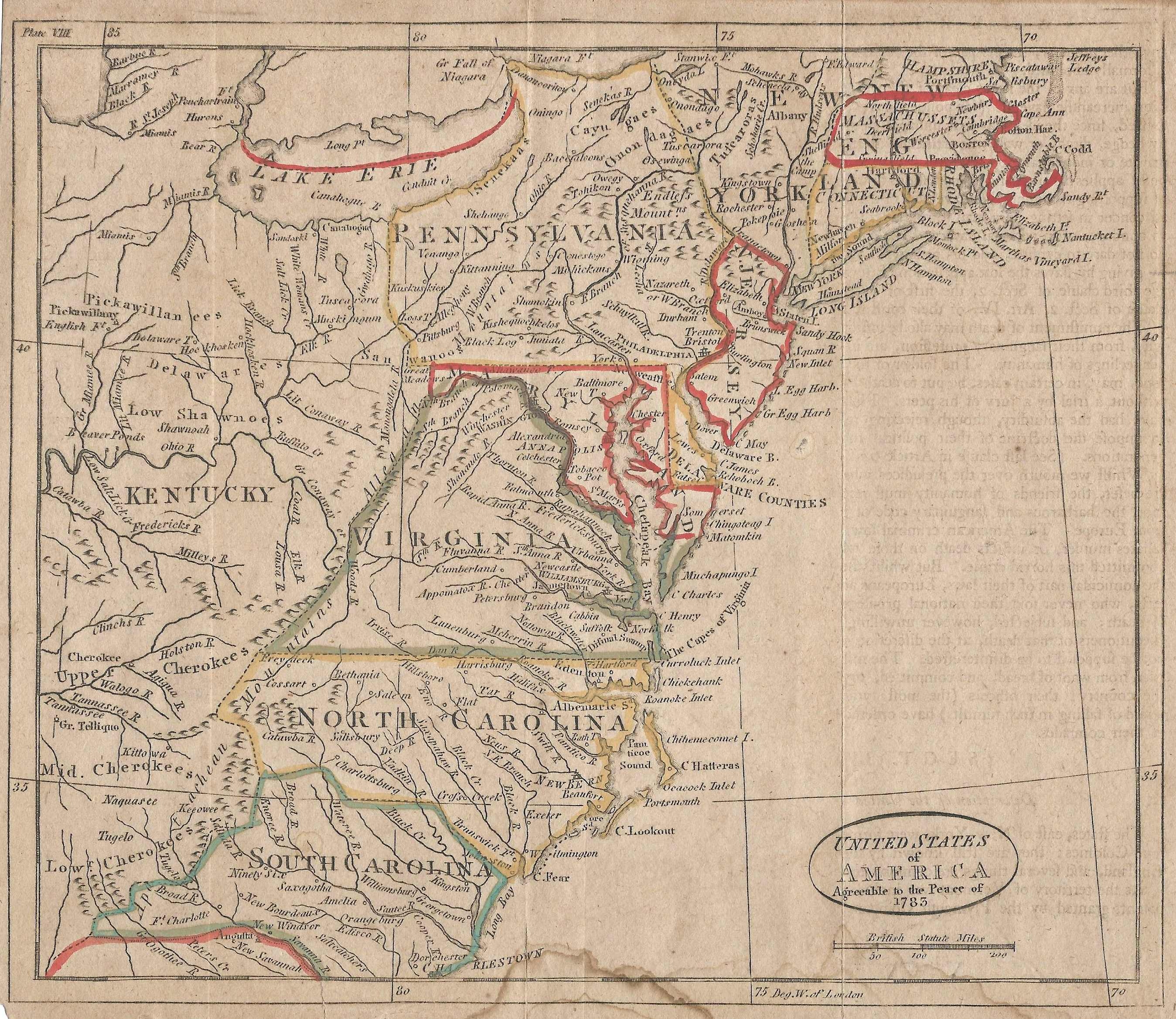
1785.4
A MAP OF THE UNITED STATES OF AMERICA, agreeable to the
Peace of 1783. Engraved for Guthries New System of
Geography. Publish'd as the Act directs June 15th. 1785
by C. Dilly and G. Robinson, London. Wm. Darton sc.
Tottenham. This map of the eastern United States to the
Mississippi appeared in several editions of Guthrie's
book. Pennsylvania's boundary extends north to Lake Ontario with an uneven western boundary.
McCorkle#785.4; Sellers & van Ee #748. Blank verso, longitude west from London. Scale: 1 inch = 102 miles. Size: 13.75 x 15.25 inches. |
 |
1785.5
ETATS-UNIS DE L'AMERIQUE SEPTENTRIONALE Avec les Isles Royale, de Terre Neuve, de St. Jean, l'Acadie &c. 1785. Supplement a l'Atlas de M. Robert de Vaugondy a Paris chez Boudet Imprimeur du Roi. This map of the eastern United States appears in editions of the Atlas Universel. The lower right corner table details the proposed states of the new United States. Later states of this map attribute it to Delamarche in the title, rather than Boudet, and the work on this map was probably done by him. This edition, with Boudet's name is most likely the first state issued in 1785 just before Vaugondy's death. The scale at the bottom appears to be inaccurate when compared to the scale derived from measuring latitude lines. Colorful hand colored cartouche. An image can be seen at mapforum.com , Issue 1; and also at the Darlington Library. Mccorkle #785.5; Sellers & van Ee #187, 761. Intaglio print. Longitude west from Ferro, blank verso. Scale: 1 inch = 120 miles. Size: 18.5 x 24.5 inches. |
 |
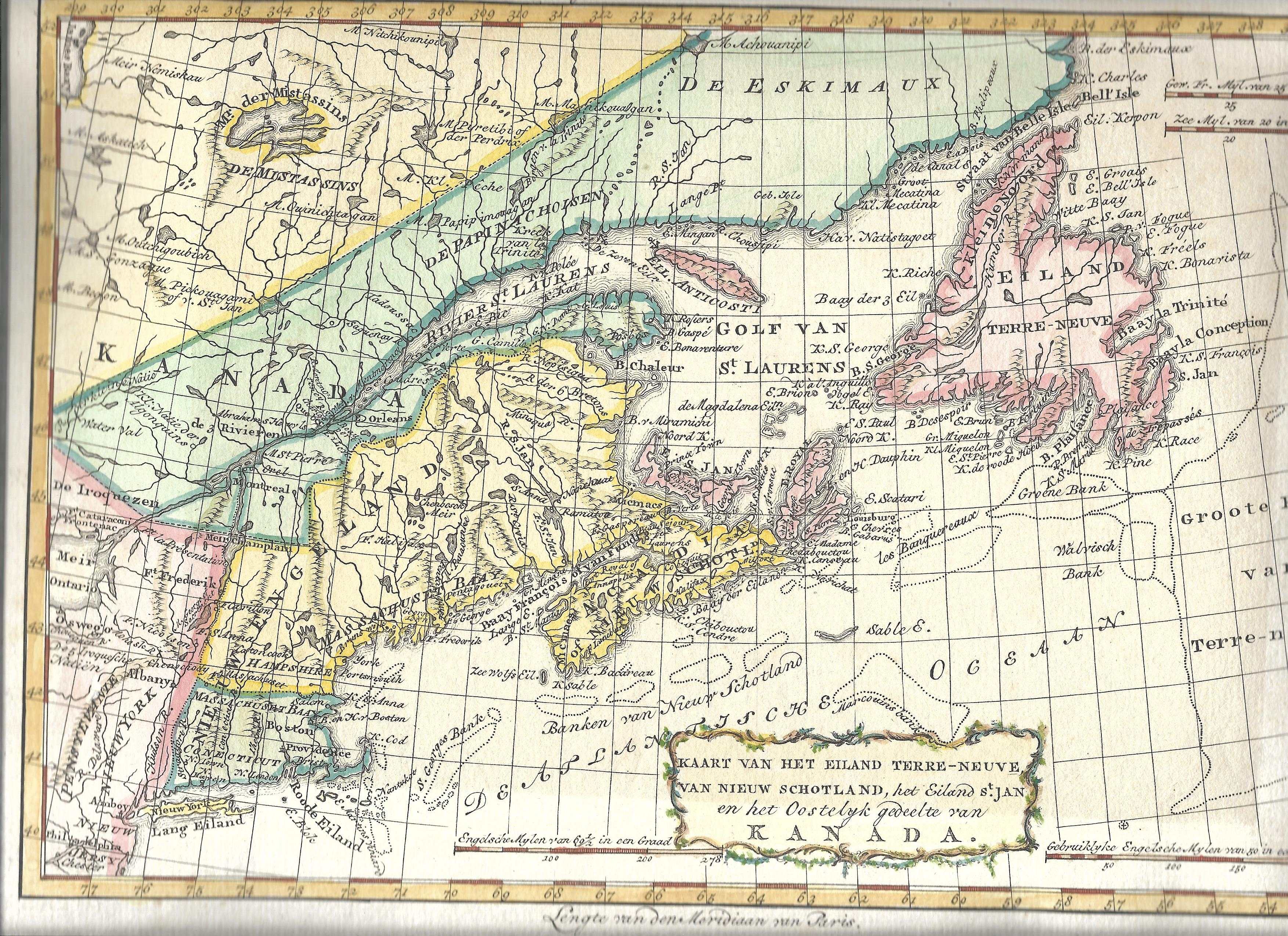
1785.6
KAART VAN HET NOORDLYK GEDEELTE DER VEREENIGDE STAATEN
VAN NOORD AMERIKA. This map appears in a Dutch atlas by W.
A. Bachiene and is attributed by McCorkle (#785.8) to J.
van Jagen. It resembles Bonne's map 1782.2. The northeast
is shown from Maine to Virginia and west to Ohio.
Pennsylvania has no north or south boundaries, and the
boundaries that are shown are weird. The coloring on this
copy is likely not original. There is a companion map of the northeast and maritime provinces: KAART VAN HET EILAND TERRE-NEUVE, VAN NIEUW SCHOTLAND, HET EILAND ST. JAN EN HET OOSTELYK GEDEELTE VAN KANADA where a small slice of Pennsylvania appears in the bottom left corner.There is also companion map of
the Great Lakes KAART VAN HET WESTELYK GEDEELTE VAN
KANADA..., also similar to Bonne's map 1782.1. The maps are
from Atlas tot Opheldering der Hedendaagsche Historie from Bachiene.
Longitude is west from Paris at the bottom and east from
Ferro at the top. Blank verso. Scale: 1 inch = 65 miles.
Size: 8.5 x 12.75 inches. |
 |
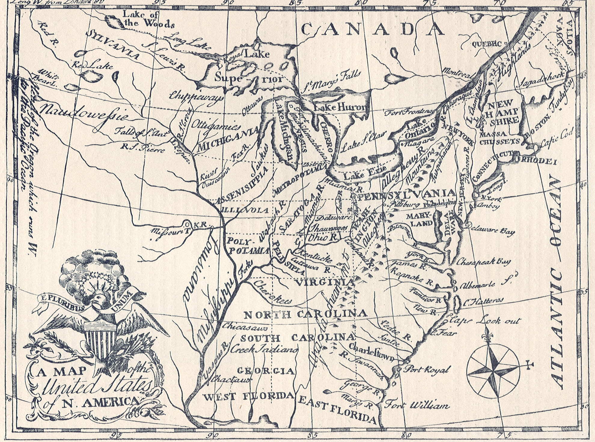
1785.7
A MAP OF THE UNITED STATES OF N. AMERICA. Philada.
Engraved by H. D. Pursell for F. Bailey's Pocket Almanac.
The title gives the source; the map was later used in a
history by John M'Culloch, a geography by Benjamin
Workman, and was copied for a German book (McCorkle #788.5).
It shows the United States to beyond the Mississippi. The
western territories are cut up into potential states with
names like Metropotamia, Illincia, Polypotamia,
Michigania, Mississippia, Saratoga. The image here is
from Winsor. McCorkle #785.11; Wheat & Brun #113,115.
|
| |
1785.8
SURVEY OF LOT NO. 121 IN DISTRICT NO. 7 BY WM. POWER FOR
E. HAND, 500 ACRES, 20TH JULY 1785. This is a manuscript
map prepared by the surveyor Power. There are hundreds,
if not thousands, of these surveyor maps from the 18th
century and this one is listed only because it appears in
Sellers & van Ee #1305. |
 |
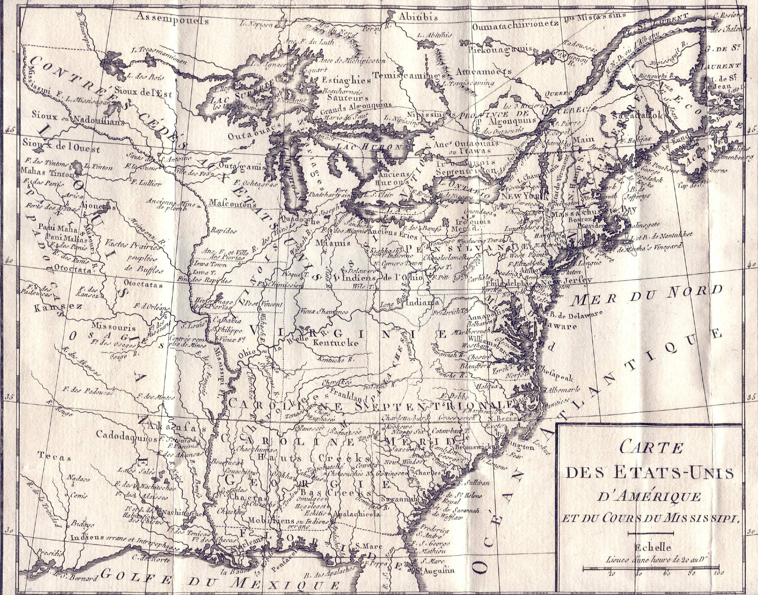
1785.9
CARTE DES ETATS-UNIS D'AMERIQUE
ET DU COURS DU MISSISSIPPI. A map by Louis Brion de la
Tour, Paris circa 1785, which is a reduced version of a
larger map of the same title (1783.3) and appeared in
volume 116 of the Histoire Universel. The area
from Maine to a cutoff Florida and west to beyond the
Mississippi is covered. Frankland in western North
Carolina predates the appearance of Tennessee. Georgia,
the Carolinas and Virginia extend to the Mississippi,
though "Kentucke" is named. A large area in the
old Northwest is identified as land ceded to the United
States. "Kansez" and "Tecas" are
named. Pennsylvania's boundary does not extend to
Lake Erie and the other state boundaries are no better.
Longitude from Paris at bottom, Ferro at top, blank verso.
Scale: 1 inch = 185 miles. Size: 9 x 10.5 inches. |
| |
1785.10
In Pursuance to the instructions of the Gentlemen
Commissioners of the State of Pennsylvania, I have made
AN ACCURATE SURVEY OF THE RIVER DELAWARE AND ITS
NAVIGABLE BRANCHES and at the request of Moore Furman ...
on the part of the State of New Jersey, by Redding Howell,
1785. A manuscript map in the New Jersey Department of
State by Reading (or Redding) Howell who made the very
famous 1792 map of Pennsylvania, see
Docktor
#285H5. |
| |
1785.11
(Eastern North America) This untitled and anonymous
French map was seen at auction dated circa 1785. It dates
to the early 1780s or later because the United States (Etats-Unis)
is identified. All of eastern North America from Labrador
to Florida and west to the Mississippi is shown. The map
is plain and simple with relatively few place names and
measures about 14 x 12 inches. |
| |
1785.12
DIE VEREINIGTON STAATEN VON NORD AMERICA. nach der von Wm. Faden 1783, herausgegebenen Charte.....des Friedenschlusses von 1783 beshtinunt sind. This German map comes from Gechichte der Revolution von Nord America von M. C. Sprengel, 1785. It is based on a map by Faden as indicated and the original English is mostly retained except for the titles. The map shows the eastern United States (and southern Canada) west to beyond the Mississippi with an inset of Newfoundland. Florida is cutoff. |
 |
1785.13
UNITED STATES OF AMERICA AGREEABLE TO THE PEACE OF 1783. An anonymous map of unknown date and origin, though probably English, this map is based on old information circa the 1750s. Pennsylvania is shown extending up to Lake Ontario for example. It was probably hastily issued to show the newly formed United States and so is dated circa 1785 here although it could date a little later. This copy is closely trimmed to the neat line and shows signs of being folded. The states are outlined in hand color. Blank verso but with a faint imprint of text visible. Intaglio print; longitude west from London. There is a mismatch between the printed scale and the scale as given by longitude lines, another indication it was quickly made and issued. Scale: 1 inch = 103 miles. Size: 8 x 9 inches. |
 |
1786.1
WESTERN BOUNDARY FROM S. W. CORNER TO 100TH MILESTONE -
1786. Mason & Dixon (see 1768.1) had ended their
survey 230 miles from the beginning of the West Line.
The land beyond this point was considered Virginia,
not Maryland. But Pennsylvania also had a claim to said
land to extend westward five degrees in longitude, as
the charter said. In 1784 Pennsylvania and Virginia
sponsored a survey to establish a southern boundary by
simply extending the Mason & Dixon line westward. The
western terminus was set at about 80d 31m 20s to give
Pennsylvania its full 5 degrees of longitude. The
following year the same surveying team ran a line
northward 100 miles along this longitude to establish a
western boundary between Virginia and Pennsylvania. This
map shows the southwestern corner of the state resulting
from the surveys. The image is from a reproduction of the
original map published in 1887 by the Pennsylvania
Secretary of Internal Affairs in a report that contained
maps of all the state boundaries. Scale: 1 inch = 0.5
mile. Size: 29 X 16 inches. The Pennsylvania State
Archives has a manuscript version, see
Docktor
#286P2. |
 |
1786.2
CARTE POUR SERVIR AU JOURNAL DE MR. LE MQUIS. DE
CHASTELLUX redigee par Mr. Dezoteux officier dans l'Etat
Major de l'Armee. Aldring sculp. This simple map appeared
in Chastellux's Voyages..., Paris 1786. There
were several versions illustrated by McCorkle #786.1, 787.4.
The English version is Travels in North-America, in
the years 1780, 1781, and 1782. By the Marquis de
Chastellux. Tr. from the French by an English
gentleman, who resided in America at that period. With
notes by the translator; Dublin, printed for
Colles, Moncrieffe, White, H. Whitestone, Byrne, Cash,
Marchbank, Henry, and Moore, 1787. The French title of
the map is also in English. Pennsylvania just makes it
onto the western edge. There is an accompanying map of
the Middle Atlantic region with the same title; southeast
Pennsylvania just makes it onto the top of it. These English versions are shown below as map 1787.16. Scale: 1 inch ~ 50 miles. Size: 7.25 x 9.5 inches. |
| |
1786.3
A NEW MAP OF THE UNITED STATES... Robt. Sayer 10 June
1786. This is a reissue of map 1774.4 with a new title
containing "United States." McCorkle #786.2 |
| |
1786.4
(Bethlehem) This is a manuscript surveyed land map in
German with an indistinct title online at the Bethlehem
Digital History Project
and dated 1786. |
| |
1786.5
(Pennsylvania - New York Boundary) The Historical Society
of Pennsylvania has several manuscript maps relating to
the Pennsylvania - New York border survey circa 1786, see
Docktor
#286E5, #286E5.01, #290A5;
also #286E5.02. Reproductions of these were also
published in the 1887 report by the Pennsylvania
Secretary of Internal Affairs mentioned above. |
| |
1786.6
BUTLER COUNTY. A manuscript map at the Darlington Library has this title in handwriting at the top. The library titles the map 'Donation lands of western Pennsylvania' and dates it circa 1786. It shows a land survey for plots given to Revolutionary War veterans in lieu of service.
|
 |
1786.7
DES POSSESSIONS FRANCOISES AUJOURD'HUI SOUS LA DOMINATION ANGLOISES. Sources indicate this undated and anonymous French map is by Jean Baptiste Louis Clouet, and dates to 1786. It Illustrates the French and British possessions in the eastern part of North America. The British colonies stretch from Florida to Newfoundland and are confined east of the Appalachian mountains. The French Louisiana takes in the entire region west of the mountains. A feature of the map is a system of lakes and rivers stretching from Lake Superior toward the Pacific; the mythical river of the west makes an appearance flowing from the Lake of the Woods. The map is flanked by columns of text that describe the colonial possessions, major settlements, and indigenous people. Blank verso, longitude appears east of Ferro (or maybe Paris). Scale: 1 inch = 214 miles. Size: 12 x 13.5 inches (map). |
 |
1787.1
CARTE GENERALE DES ET ETATS DE VIRGINIA, MARYLAND,
DELAWARE, PENSILVANIE, NOUVEAU-JERSEY, NEW-YORK,
CONNECTICUT ET ISLE DE RHODES AINSI QUE DES LAC ERIE,
ONTARIO, ET CHAMPLAIN D'APRES LA CARTE AMERIQUAINE DE
LOUIS EVANS ET LA CARTE ANGLAISE DE THOMAS JEFFERYS.... T.
II P. 1; grave par P. F. Tardieu (McCorkle #787.6;
Sellers & van Ee #717). This map was published in
Michel de Crevecoeur's Lettres D'un Cultivateur
Ameriquain, Cuchet, Paris 1787, which was a later
French edition of the essays first published under the
title Letters from an American Farmer (and under
the pen name J. Hector St. John) in London 1782. The map
includes southern Canada, the northeast south to Virginia
and west to Ohio with an inset of Lake Michigan and the
upper Mississippi titled ESQUIS SE DURESTE DE LA RIVIERE
DE L' OHIO. Only the Pennsylvania region is shown here
from this large map. Cte (county) de la Fayette in
western Pennsylvania is cited which would date the map
after 1783; Bedford and Washington counties are also
named but no others. This French map is based upon the
famous Lewis Evans map of 1755 published by Jeffreys, and
retains many inscriptions in English. Delaware is named
but no boundary is shown between it and Pennsylvania. The
Philadelphia meridian is used and the Pennsylvania - New
York line is correctly shown near the 42nd parallel. In
1801 Crevecoeur published Voyage dans la haute
Pensylvanie et dans l' tat de New-York : par un membre
adoptif de la nation On ida, Traduit et publie par
l'auteur des Lettres d'un cultivateur am ricain.
Paris : Maradan, 1801. This volume also contains several
maps. Listed on page 866 of Phillips. Blank verso. Scale:
1 inch = 35 miles. Size: 19 x 26 inches. |
| |
1787.2
CARTE GENERALE DES ETATS-UNIS DE L'AMERIQUE
SEPTENTRIONALE, renfermant aussi quelques Provinces
Angloises... Grave par P. F. Tardieu. This is another map
from Crevecour's Lettres d'un cultivateur americain,
covering eastern North America from Newfoundland to
Florida and west to beyond the Mississippi. It is similar
to #1797.6 for which an image is shown. McCorkle #787.8. |
 |
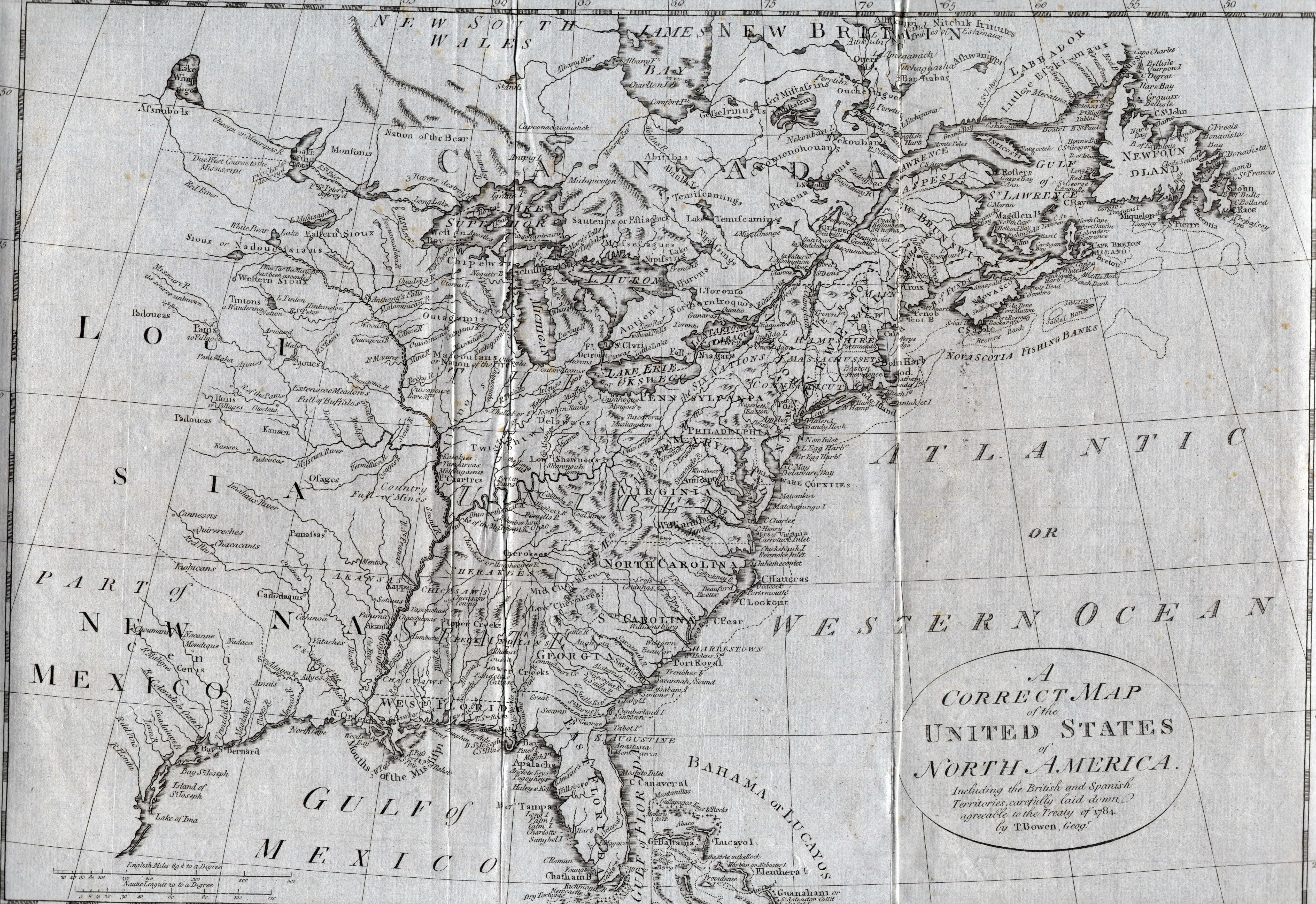
1787.3
A CORRECT MAP OF THE UNITED STATES OF NORTH AMERICA,
INCLUDING THE BRITISH AND SPANISH TERRITORES, CAREFULLY
LAID DOWN AGREEABLE TO THE TREATY OF 1784, by T. Bowen,
Geogr. Engraved for Bankes's A New Royal, Authentic, and
Complete System of Universal Geography, published by
Royal Authority (McCorkle #787.1). Phillips, page 865,
gives c1787-1810 for publication of Thomas Bankes
geography by J. Cook, London. Bowen died in 1790 (Lister)
so map preparation must date c1784-90. Sellers & van
Ee #756 date it 178?. The Delaware counties are included
with Pennsylvania. The treaty of 1784 refers to the end
of the Revolutionary War. Longitude is west from London.
Blank verso. Scale: 1 inch = 160 miles. Size: 12.5 x 17.5
inches. |
| |
1787.4
CARTE REDUITE DU NORD DES ETATS-UNIS AVEC L'INTERIEUR DU
PAYS. This map is from a French history of the
Revolutionary War and Pennsylvania just makes it onto the
western edge. McCorkle #787.3 |
| |
1787.5
ETATS UNIS DE L'AMERIQUE. This is a map of the eastern
United States from Lattre's Petit Atlas Moderne,
Paris circa 1787-97. Pennsylvania extends to the 43rd
parallel and west into Ohio. McCorkle #787.5 |
| |
1787.6
NORTH AMERICA INCLUDING THE BRITISH COLONIES AND THE
TERRITORIES OF THE UNITED STATES. S. Hollingsworth fecit.
D. Lizars sculpt. Edinr. A map of the northeast from
Virginia to Newfoundland and west to the Great Lakes, it
appeared in The Present State of Nova Scotia...,
Edinburgh 1787. Pennsylvania extends to the 43rd parallel
with an irregular western boundary. Philadelphia and
Lancaster are identified, nothing else. McCorkle #787.7;
Sellers & van Ee #191. |
| |
1787.7
(Northeast Coast) An untitled map from Histoire des
troubles de l'Amerique Anglaise by Francois Soules,
Paris 1787, which shows the coast and some distance
inland from Cape Henry to Boston. See also map 1782.13.
McCorkle #787.9 |
 |
1787.8
A MAP OF THE COUNTRY BETWEEN ALBEMARLE SOUND, AND LAKE
ERIE, COMPREHENDING THE WHOLE OF VIRGINIA, MARYLAND,
DELAWARE AND PENSYLVANIA, with parts of several other of
the United States of America. Engraved by S. J. Neele.
London, John Stockdale, 1787. This map is attributed to
Thomas Jefferson and was published in his Notes on
the State of Virginia. As the title says, it
includes all of Pennsylvania shown here in a detail from
the Library of Congress copy, Phillips page 984. The map
is illustrated and discussed in Pritchard &
Taliaferro #72. |
 |
1787.9
PLAN OF THE LOTS LAID OUT AT PITTSBURG AND THE COAL HILL.
Copied by John Hills, surveyor, Philadelphia 1787. This
is a manuscript landownership map in the Library of
Congress, Sellers & van Ee #1333. There is a similar
manuscript map dated 1787 in the Darlington Memorial
Library at the University of Pittsburgh. Coal Hill is now
called Mount Washington, a name more suitable for upscale
living. This image is from the Library of Congress. |
| |
1787.10
A DRAUGHT OF TEN LOTS OF GROUND IN THE NORTHERN LIBERTIES
OF THE CITY OF PHILADELPHIA, surveyed the 28th August
1787..., a manuscript landownership map in the Library of
Congress, Sellers & van Ee #1328. |
| |
1787.11
PLAN OF
THE LOTS ON THE GERMANTOWN ROAD AND SIXTH STREET IN THE
NORTHERN LIBERTIES OF THE CITY OF PHILADELPHIA, THE
PROPERTY OF SAMUEL DICKENSON. An anonymous and undated
land owership manuscript map dated circa 1787 by the
seller. Lot owners
named include Samuel Mifflin, the Estate of William
Masters Esq., Jacob Rihl, Chas O Niell, John Snyder,
Jacob Bowers, Caspar Albert, Michl. Meyer, John Weiser,
Thomas Mount, William Henry, William Smith and Nathaniel
Gosling. Dickenson was apparently a major land holder in
this area. This map was seen for sale and there are
probably many unrecorded survey maps like this in
archives and attics. |
| |
1787.12
(Samuel Vaughan Diary) Samuel Vaughan created a diary
circa 1787 that contains a number of manuscript maps of
various places, among them Fort Pitt, Youghiogheny River
(Ohiopyle) Falls, and Carlisle; see
Docktor
#287V5, #287V5.01 - 02. The
diary is apparently now in the Library of Congress. |
| |
1787.13
THIS MAP OF PART OF THE NORTHERN BOUNDARY OF PENNSYLVANIA... This two sheet manuscript map can be seen at the Darlington Library dated circa 1787. It was prepared by Benjamin Ellicott as part of the boundary survey and is inscribed to the Supreme Executive Council of the Commonwealth. It appears to be a fragment.
|
| |
1787.14
A MAP OF PENNSYLVANIA DIVIDED INTO ITS COUNTIES AND EXHIBITING THE PROPERTY OF JOHN PENN, JUNR. ESQUIRE. This large four sheet manuscript map can be seen at the Darlington Library and is dated 1787. It appears to be a hand copy of the 1770 printed map of Pennsylvania by William Scull.
|
 |
1787.15
CHART FOR THE JOURNAL OF MR. LE MQUIS. DE CHASTELLUX. There are two maps of this title in Travels in North-America,
in the years 1780, 1781, and 1782 by the Marquis de Chastellux translated from the French by an English gentleman,
who resided in America at that period; with notes by the translator, Dublin 1787. The maps are by 'Mr. Dezoteux staff officer in the French army.'
The first map (at left) shows the coast from southern Maine down to New Jersey and includes eastern Pennsylvania. It is the same as map 1786.2
above except for the English title. The second map is slightly larger and has the same title but shows
the region from Philadelphia south to Cape Henry and west to the mountains. Scale: 1 inch ~ 50 miles. Size: 7 x 9.25 inches.
|
 |
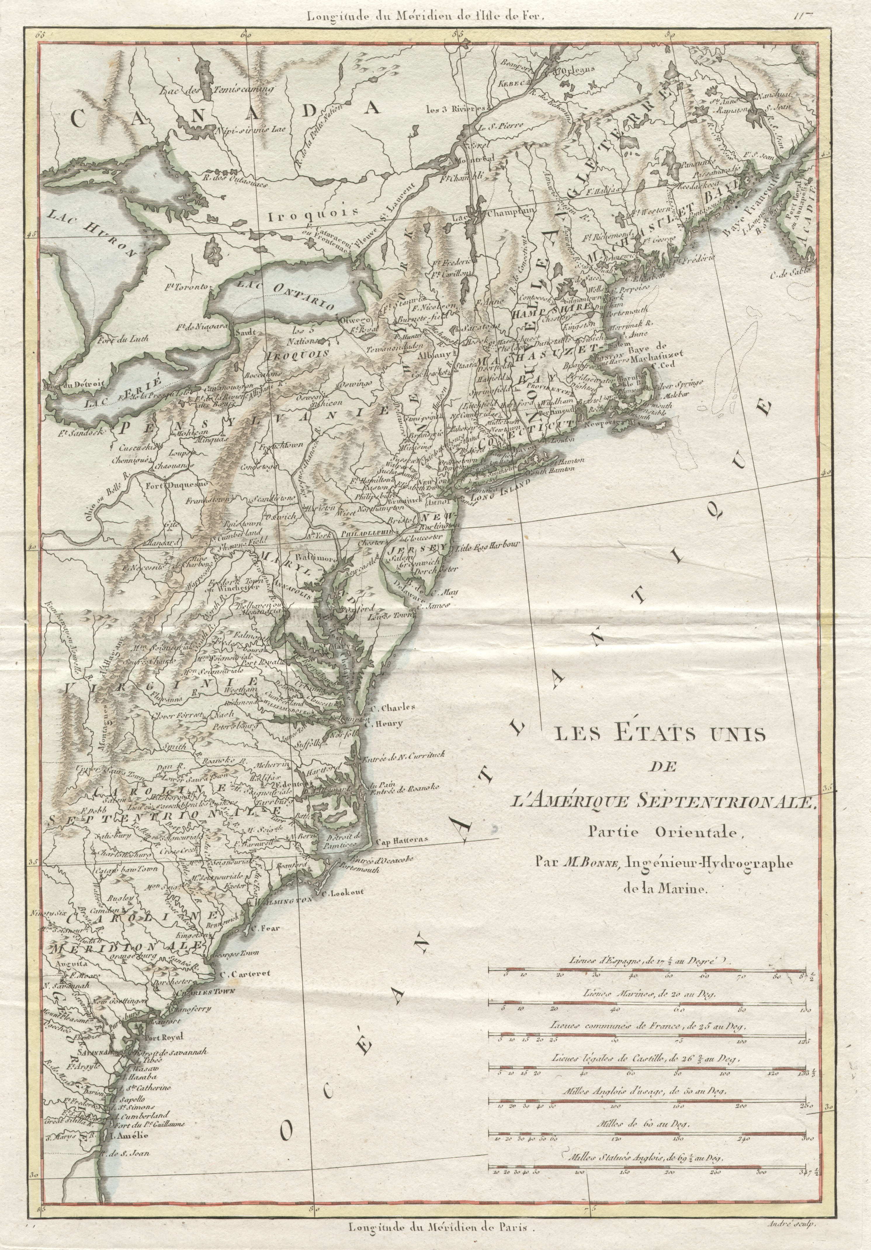
1788.1
LES TATS UNIS DE L'AM RIQUE SEPTENTRIONALE. PARTIE
ORIENTALE. par M. Bonne, Ing nieur-Hydrographe de la
Marine. Andre sculp. This map is plate 117 from Nicolas
Desmarest & Rigobert Bonne's Atlas
Encyclopaedique 1788. The map shows early forts and
names such as the Iroquois. The hand coloring may have
been done at a later date. Listed in Phillips page 867
and also as McCorkle #788.1, Sellers & van Ee #794.
There is a companion plate 118 titled 'Partie Occidentale.'
This map can also be seen at
MapForum.Com
, Issue 1, the January 1999
edition, which includes a checklist of United States maps
to 1800. Longitude from Paris at bottom, from Ferro at
top. Blank verso. Scale: 1 inch = 50 miles. Size: 14 x 9.5
inches. |
 |
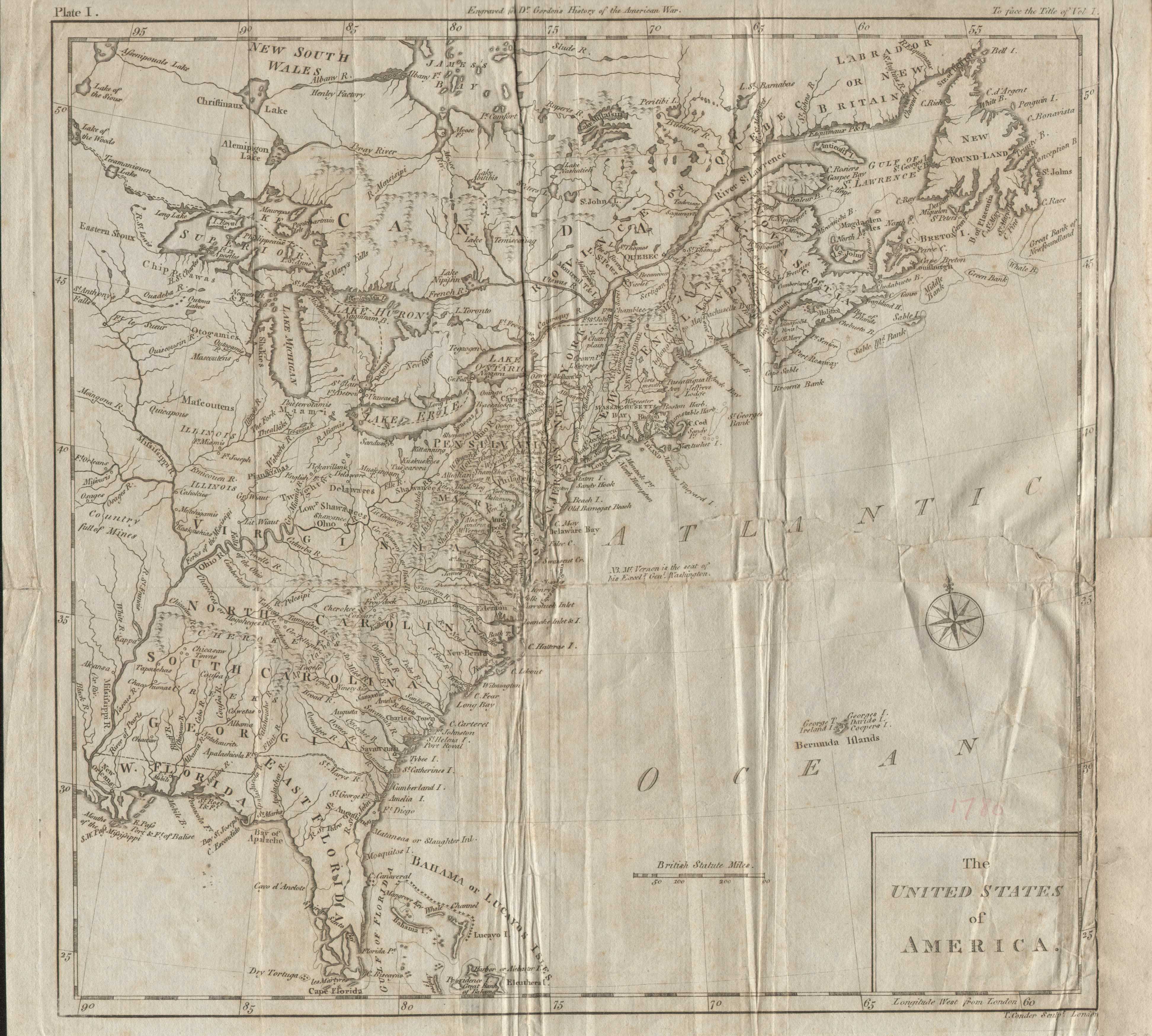
1788.2
THE UNITED STATES OF AMERICA. T. Conder sculpt. London. Plate I. Engraved for Dr. Gordon's History of the American War. This map
appears in The History of the Rise, Progress... of
the United States of America by William Gordon,
London 1788. It shows the familiar region from
Newfoundland to Florida and west to the Mississippi. An interesting feature is a note just off Virginia giving the location of Mount Vernon. Blank verso, longitude west from London. Scale: 1 inch = 182 miles. Size: 11 x 11.5 inches.
McCorkle #788.3 |
 |
1788.3
GENERALKARTE VON NORDAMERICA SAMT DEN WESTINDISCHEN
INSELN verfasst von Herrn Pownall neu herausgegeben von F.
A. Schraembl MDCCLXXXVIII. This is a German map, by Franz
Anton, of the east coast from Newfoundland to the
Carolinas. Two-thirds of it is taken up by the Atlantic
Ocean and an enormous cartouche. It extends just far
enough west to include almost all of Pennsylvania with
its northern boundary extending to about 42d 30m as seen
in this
close up
. Lake Erie is called "Okswego
See." The map is from Schrambl's Allgemeiner
Grosser Atlas, begun in 1786. McCorkle #788.6.
Longitude west from Ferro; blank verso. Scale: 1 inch =
80 miles. Size: 20 x 22.5 inches. |
 |
1788.4
TO THE PATRONS OF THE COLUMBIAN MAGAZINE THIS MAP OF
PENNSYLVANIA IS DEDICATED BY THEIR OBLIGED AND OBED'T
SERV'NTS THE PROPRIETORS. A map in the Columbian
Magazine, v. 2, for T. Seddon, Philadelphia 1788.
This same map appeared as A POCKET MAP OF THE STATE OF
PENNSYLVANIA. Philadelphia: Printed by William Spotswood
1790. Circa 1937-39 the United States Constitution Sesqui-centennial
Commission had photostatic copies made of maps of all 13
original states, plus some US maps, as they were at the
time of the Constitution adoption, circa late 1780s. For
some reason, likely its date, they picked this map to
represent Pennsylvania. The reproduction, as can be seen,
is poor by modern digital standards. Phillips page 678,
Wheat & Brun #426, 431. |
| |
1788.5
A PLAN OF THE TOWNSHIPS OF MOYAMENSING AND PASSYUNK THE
DISTRICT OF SOUTHWARK IN THE COUNTY OF PHILADELPHIA AND
IN THE STATE OF PENNSYLVANIA shewing the intended New
Roads and Streets as laid out by the Commissioners
appointed by the General Assembly in the Year 1787, by
John Hills. Surveyed by John Hills 1788. A manuscript map
of what is today South Philly in the Philadelphia City
Archives. There are two manuscript versions by Hills and
two circa 1790 copies by Charles de Krafft. The Krafft
copy is illustrated in M. P. Snyder, Figure 90. |
 |
1789.1
A NEW MAP OF THE STATES OF PENSYLVANIA NEW JERSEY NEW
YORK CONNECTICUT RHODE ISLAND MASSACHUSETS AND NEW
HAMPSHIRE INCLUDING NOVA SCOTIA AND CANADA, from the
latest authorities, engraved for Gordon's History of the
American War. C. Tiebout Sculpt. N. York 1789. This map
is from The History of the rise, progress, and
establishment, of the Independence of the United States
of America : including an account of the late war, and of
the Thirteen Colonies, from their origin to that period, by
William Gordon, D.D., in three volumes, New-York :
Printed by Hodge, Allen, and Campbell, and sold at their
respective book-stores, 1789; as listed in the LOC
catalog. The map shows the northeastern United States,
the Great Lakes area and much of eastern Canada. Several
towns are named including Bedford, Ft. Pitt, Venango Ft;
rivers are shown and named. A key at the right side of
the map provided symbols for boundaries, towns, forts and
Indian villages. The first edition was published in
London in 1788 (see 1788.2) and then in New York in 1789;
the LOC also has 1794, 1801 editions. Listed in McCorkle
#789.9, Sellers and Van Ee #197. Originally folded, blank
verso, longitude from London at top, Philadelphia at
bottom. Scale: 1 inch = 112 miles. Size: 10.5 x 16 inches. |
 |
1789.2
MAP FOR THE INTERIOR TRAVELS THROUGH AMERICA, delineating
the march of the army. T. Conder sculpsit. This map is
from Travels Through the Interior Parts of America
by Thomas Anburey, London 1789, and includes the region
from Maine to Viriginia and west to Lake Erie. Most of
Pennsylvania is shown and a few towns in the east named,
especially Valley Forge. Auburey was an officer in the British army of General John Burgoyne, and his account is one of better ones. The map is color coded to illustrate the marches as described at top left. The four marches shown on this copy are: Fort Ticonderoga to Saratoga; Saratoga to Charlottesville; Charlottesville to Lancaster; and Lancaster to New York. Although six routes are indicated in the legend, only four (brown, green, yellow, blue) are marked on this copy. This is an unusual map in that the printed legend of the marches requires a hand addition. McCorkle #789.5. Size: 15.75 x 14 inches. Scale: 1 inch = 39 miles. |
 |
1789.3
A MAP OF THE NORTHERN AND MIDDLE STATES; comprehending
the Western Territory and the British Dominions in North
America. Compiled from the best authorities. Delineated
and engrav'd for Morses Geography by Amos Doolittle New-Haven.
This map appeared in the American Geography by
Jedidiah Morse. It shows the area from Labrador to
Virginia and west to include the Great Lakes.
Pennsylvania is shown with the modern boundaries but
without the Erie triangle. There is a table at top left naming counties in New York and New England. Morse's geography contained an accompaning southern states map. McCorkle #789.6;
Sellers & van Ee #194; Wheat & Brun #149, 153. Blank verso, longitude west from London at top, from Philadelphia at bottom. Scale: 1 inch = 111 miles. Size: 12.5 x 15.5 inches. |
 |
1789.4
NORTH AMERICA wherein are particularly distinguished the
British Dominions, the United States, and the adjacent
Spanish territories. By Thomas Kitchin hydrographer to
His Majesty. London Printed for Robert Sayer Fleet Street
as the Act directs June 1st. 1789. A map of eastern North
America. McCorkle #789.8, 794.11. Image from the Heritage
Map Museum CD by permission. |
 |
1789.5
PLANO DE LA BAHIA DE LA WARE Y ENTRADA DE FILADELFIE...,
a manuscript map of Delaware Bay attributed to Jossef del
Campo, probably copied from Joshua Fisher's map 1775.7.
This image is from the Library of Congress where the map
is dated 178?. Sellers & van Ee #1373. For a similar
Spanish manuscript map, see
Docktor
#28_U5, #284C5. |
| |
1789.6
DESCRIPCION HIDOGRAFICA, QUE COMPREHENDE LA AMERICA
SEPTENTRIONAL, DESDE LA PUNTA, Y RIO DE SN. JUAN, HASTA
FILADELFIA..., a manuscript map of the east coast from
Delaware Bay south which includes three profiles of the
entrance to Delaware Bay. This map, attributed to del
Campo, was probably made around the same time as the one
above, and is dated 178? by Sellers & van Ee #765. |
| |
1789.7
FROM NEW YORK (46) TO FRANKFORD; FROM NEW YORK (47) TO
PHILADELPHIA; FROM PHILADELPHIA (51) TO ANNAPOLIS
MARYLAND; FROM PHILADELPHIA (52) TO ANNAPOLIS MARYLD.
These are a series of road maps, all in three vertical
strips, that appeared in A Survey of the Roads of the
United States 1789 by Christopher Colles, see the
References. Wheat & Brun #427-30. |
 |
1789.8
(Southeastern Pennsylvania) This untitled map of
southeastern Pennsylvania, northern Maryland and Delaware,
appeared in the Transactions of the American
Philosophical Society in 1789. Its purpose was to
show a proposed road network. It is illustrated in a
detail in Papenfuse & Coale and here in a photo. The
contraption on the left has nothing to do with the map. |


