
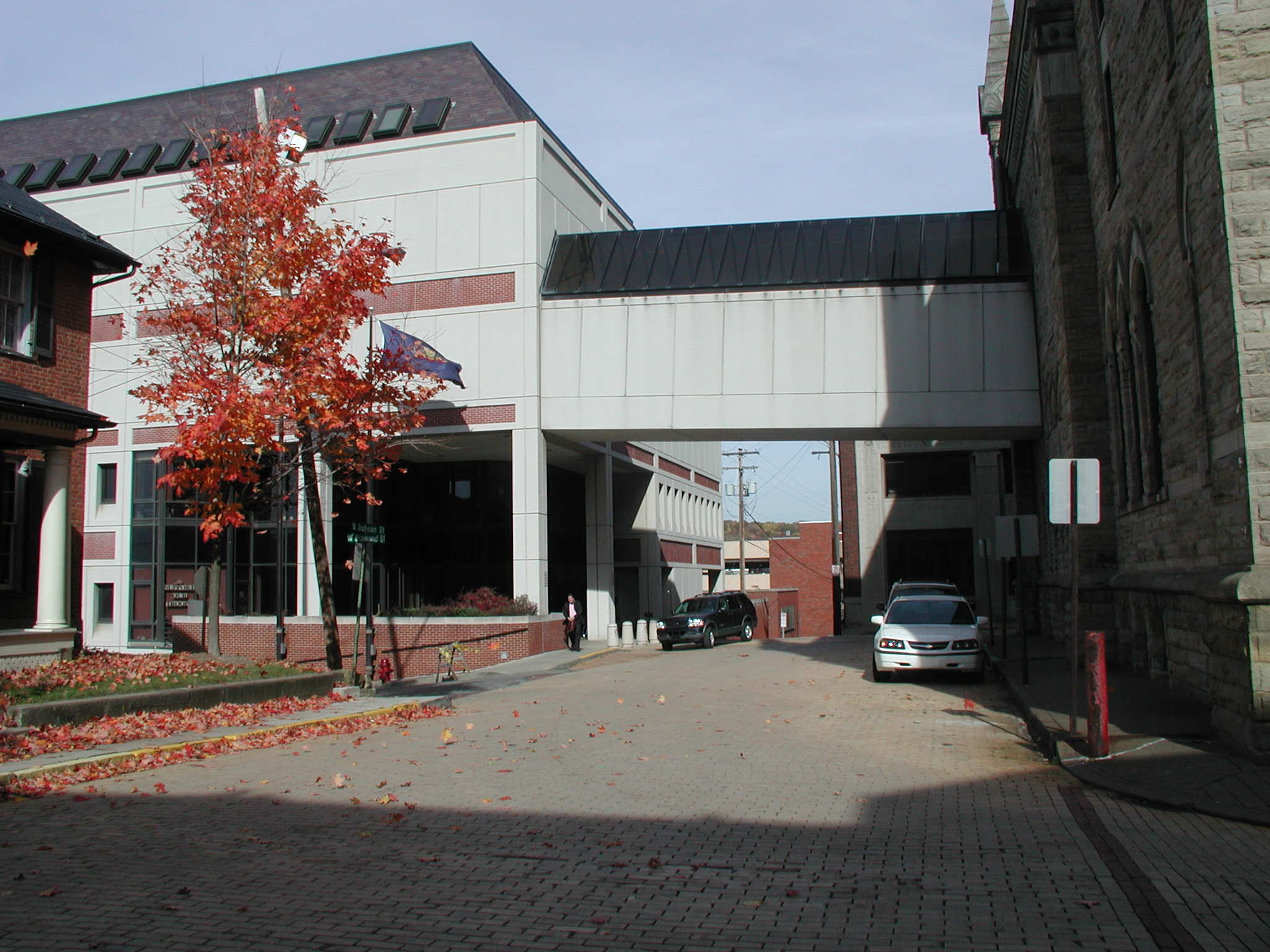
The Courthouse (1859). The original courthouse sat right in the town square, now called Lincoln Square, from 1804 to 1859. The next courthouse, built a block south on a corner lot in 1859, was preserved and restored to its Civil War look after construction of the present modern courthouse. Both buildings are used for trials. The old courthouse is brick in a mixture of styles, a flat Federal front under a classical pediment and rather unusual tower. There is extensive decorative bracketing under the eaves. The protruding section at the back was added in 1906 giving the structure a "T" shape. The modern courthouse was put up around 1980 in a brick utilitarian style. The best that can be said about this building is that it blends into the block and is not noticed. If that was the intent, then good job well done. It is connected to the 1906 part of the old courthouse at the back. The two buildings are also connected at the front near the sidewalk by an open covered walkway.

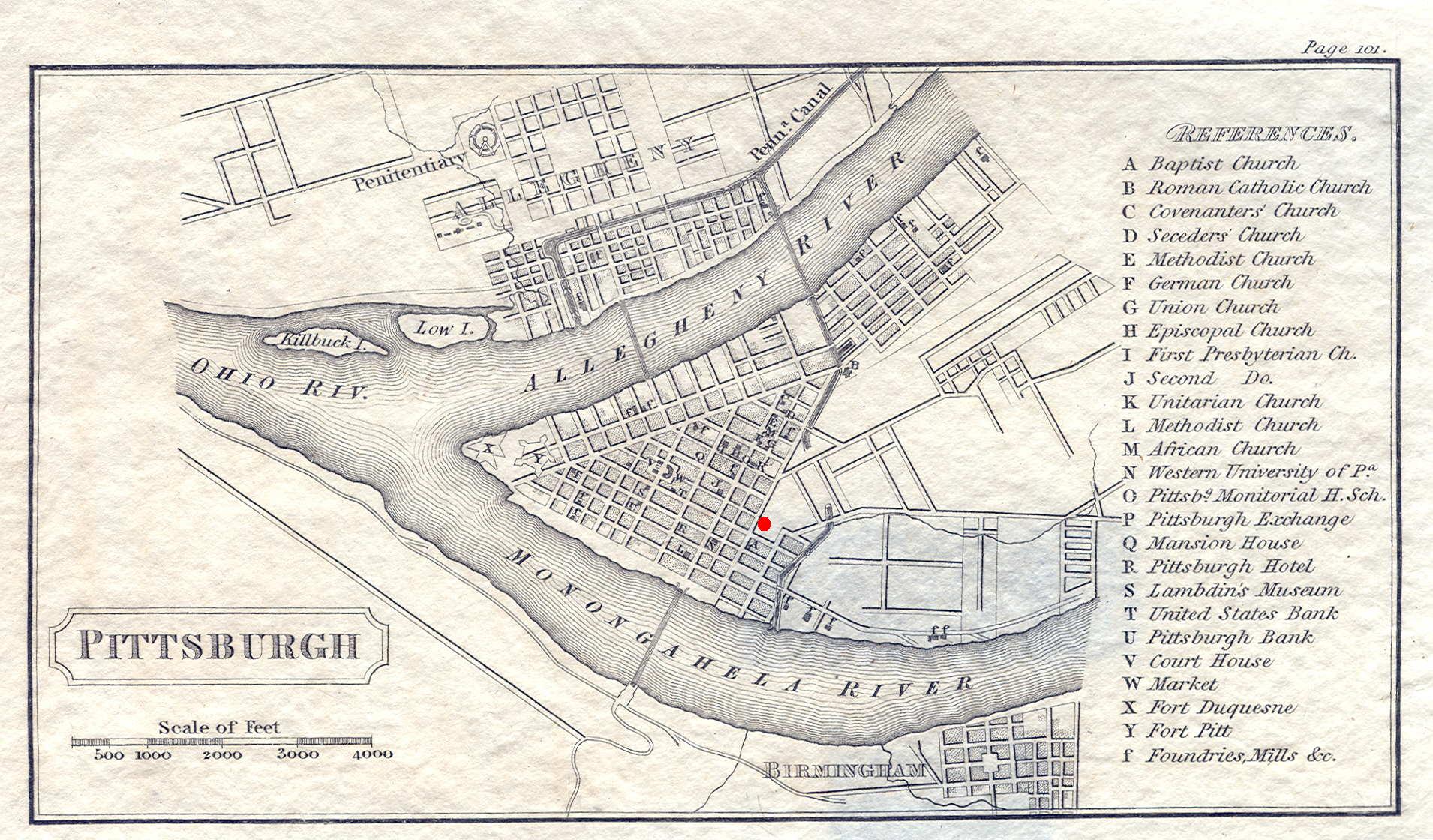
The Courthouse (1888). Allegheny County was formed in 1788 and the first court sessions held in a tavern, as was the case with many of the western frontier counties. Shortly after, the first courthouse was built on today's Market Square, a simple frame structure. This was followed by a more substantial brick building in 1799, noted on the map. A much larger Neoclassic courthouse was constructed around 1842 at the present location on Grant Street, and burned in 1882. Designed by Henry Hobson Richardson (who died during construction) and built in 1884-88, the present Allegheny County courthouse is one of the most architecturally significant in the country. It is an excellent example of Richardson's style, called Richardsonian Romanesque. The courthouse sits on its own block with narrow side streets on three sides and facing the wider Grant Street. One of the purposes of the large tower at the front was to increase natural circulation in the days before air conditioning. Entrance is through the arches under the tower into what was originally the basement, as the street was lowered several feet after the courthouse was built. The jail, part of the original design although by another architect, is connected to the courthouse at rear over the street by a ' bridge of signs '. This old jail was gutted inside and transformed into additional courtrooms around 2002 after a new jail was built down along the Monongahela. Other court functions are in the adjacent City-County building. The courthouse completely surrounds an interior courtyard with a fountain and benches, reached through street level openings on each side. There is little iconography on the building; this is part of Richardson's utilitarian style. However, a bronze plaque of the Ten Commandments hangs on the outside. Around 2000 this caused a lawsuit on government endorsement of religion, which was dismissed on the grounds the plaque was part of the building's history. This courthouse is the second most architecturally important building in western Pennsylvania, after Frank Lloyd Wright's Fallingwater in Fayette County. It is the only Pennsylvania county courthouse that is a National Historic Landmark. (Philadelphia City Hall is also a NHL, but is not, obviously, called a courthouse.) For more on this courthouse, see Great Buildings. And if one is not enough, there is a second Richardson building in Pittsburgh, the Emmanuel Episcopal Church, also a National Historic Landmark.

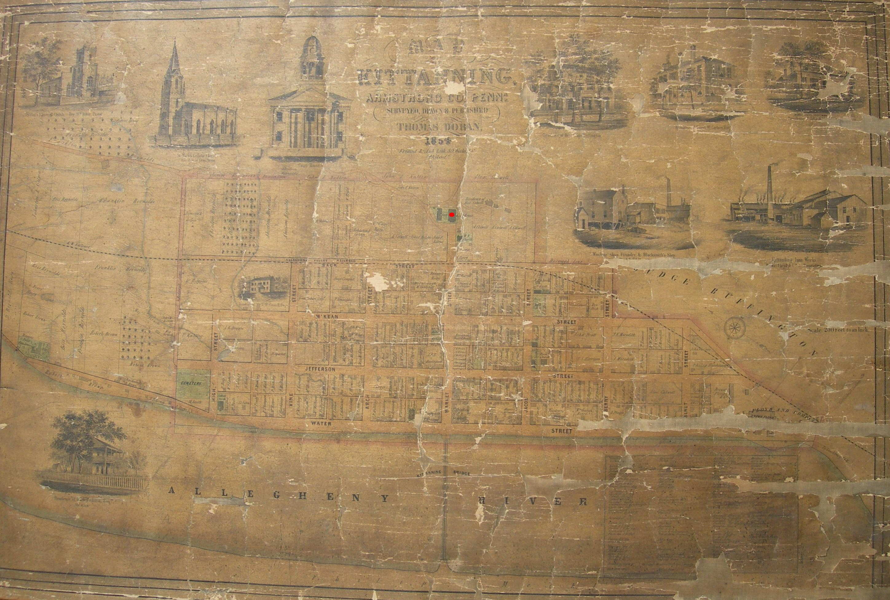
The Courthouse (1860). The first courthouse was built of brick in 1809. The original part of the present courthouse was built in 1860, with additions in 1871, and the jail on the left added in 1873. The photo can be compared to this old county atlas view made shortly after building the jail. Later unobtrusive additions were made at the rear in the 20th century along with interior modernization, and to the right is a separate modern annex connected by a enclosed sidewalk. This Neoclassic structure is entered through the three arches under the portico. The courthouse sits conspicuously at the end of the main street in Kittanning dug into the base of a hill and faces the bridge over the Allegheny River as shown on the map.


The Courthouse (2003). The circa 1840 vintage courthouse is shown on the left in this old view. The present courthouse is one of the newest in the state, dedicated in 2003. It sits on the site of an 1875 building rebuilt in the 1930s after a fire. That old courthouse was demolished and only two art deco reliefs were saved, now displayed in two small interior courtyards. Entrance is at the south front or in the rear annex next to the parking lot. This is a modern two story design in buff stone with projected wings connected by a central section and a glass-enclosed atrium at the front first floor. A curved pavilion connects the two wings in the front as a decorative touch, and a glass-enclosed tower with a clock is above the entrance. Unlike some other modern courthouses, the architects of this one have given it some character. The overall style seems vaguely Art Moderne with the tower adding classical courthouse continuity.


The Courthouse (1828). This is the oldest courthouse in the state still used as such, built in 1828 by a local builder named Solomon Filler, and slightly enlarged at the back in 1876; although as might be expected from its date, this is not a large building. The courthouse sits on a narrow lot on the southwest corner of the town square which is quartered by an intersection (Penn & Juliana), as shown in this old view looking south. It is of brick and wood in a transition style from Federal to Classical Revival, which makes sense given when it was built. Two columns with corner pilasters frame the recessed entrance beneath a lunette in the gable. The bell and clock tower is rather simple in form, as these things go. Currently (2006) annex buildings are under construction to the rear and the nineteenth century building next door (along with its two small outbuildings) is being renovated, all eventually to form a county complex resembling this architect rendering .


The Courthouse (1931). Berks is a major eastern county and Reading a good sized city, which perhaps explains the courthouse, a skyscraper sitting just off the town center. This form likely resulted from the restricted building site. The stone clad building was put up around 1931 in the Art Deco style of the time. The two wings go up nine stories and the central building nineteen. There are bas-reliefs above the entrances and around the top including large eagles on each side. The interior is also quite decorative and, on height alone, this is certainly one of the most impressive courthouses. It is also a good example of planning ahead. In 1931 no one probably even imagined that all nineteen floors would ever be needed.


The Courthouse (1877). This attractive building sits on one of the narrow streets making up the old downtown of Hollidaysburg. With its narrow streets and small blocks, Hollidaysburg has a colonial feel, unusual for a western town. The front, in a Gothic style, dates to 1877 and the rear projecting section is an addition of 1906 done in the same style, even to matching the facing stone and trim. The clock tower rises out of the back center and the Gothic front is churchlike with the towers framing the triple arch entrance. On the left down the street is a modern annex built to blend with the courthouse if one doesn't look up.


The Courthouse (1897). This handsome courthouse was built in 1897 and occupies its own block formed by two narrow side streets. It reflects a variety of styles; the long arched windows and rough stone facing over all but the front suggest Romanesque. Williams calls the style Renaissance Revival; although the large dome, the cruciform shape, and when it was built indicate Beaux Arts influences also. The projected front is very handsome with the smaller end windows and square arches a nice touch to lessen the monotony of everything looking the same. The statue atop the dome is "Lady Justice" holding her scales. The rear projects somewhat farther than the front and sides in diminishing sections. There is a small brick building on the courthouse grounds at rear which is older than the courthouse; it can be seen on the map called County Offices. The large Civil War memorial in front dates from the early 1900s.


The Courthouse (1962). Three successive courthouses have occupied the present site; the first one rather resembling a house. It was replaced in 1878, and again in 1962 by the present building. The basic shape of this courthouse is best summed up by Williams: "It is really two buildings, consisting of a round and rectangular part. Airline pilots viewing it from the air have dubbed it 'the toilet'." This is a building, or rather buildings, in the Modern style with some architectural distinction. Perhaps if it sticks around age will confer some more, as circular public buildings are rare because of the additional cost and inefficient use of space. The courtrooms are in the round part and offices in the rectangle. The two are connected by an enclosed hallway; entrance is into this hallway.


The Courthouse (1886). The previous courthouse was an 1855 Classical Revival structure which burned in 1883. The present interesting building, a combination of Romanesque and other styles, was built in 1886 and enlarged in 1908, and towers over Butler's downtown. The courthouse occupies its own block facing an open square across the street. The original look is preserved in this view from the map. The present tower roof is shiny stainless steel visible for miles on a sunny day. An unusual feature is the decorative front porch, unfortunately now closed; entry is through the modern annex at the rear attached to the courthouse by a second floor enclosed pedestrian bridge.
